Emu Plains | Lapstone | Glenbrook | Blaxland – Lennox Bridge | Warrimoo
Valley Heights | Springwood | Faulconbridge
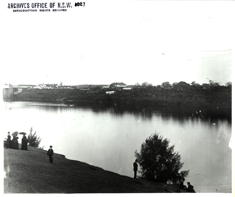
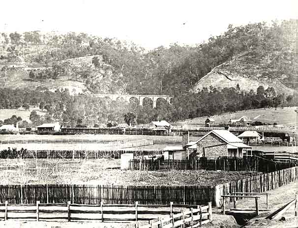
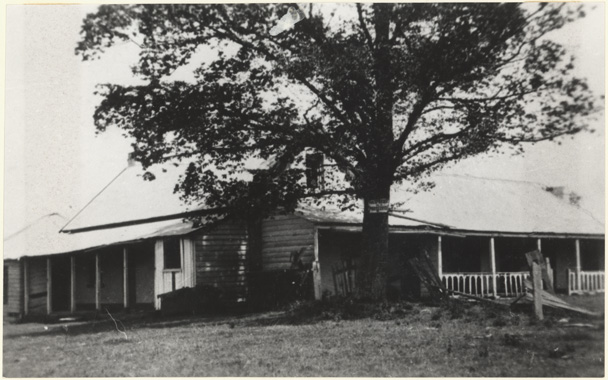
Emu Plains – at the foot of the mountains
![Emu Plains from 'Lucasville' NRS16407-1-1[6]_[Opp-p36]](/wp-content/uploads/2013/05/NRS16407-1-16_Opp-p36Emu-Plains.jpg)
Emu Plains is a town 58 km west of Sydney, located on the western bank of the Nepean River and at the foot of the Blue Mountains. As the name suggests, the area was named after the many emus that once lived there. William Cox started building the Great Western Road from here in 1814.
A government convict farm operated at Emu Plains from 1819-32 and the village began as a stopover for travellers. For many years the district was an important pastoral and orchard centre for Sydney.
In 1877 the public school opened and then in 1883 the Main Western Railway Line arrived.

Top ↑
Lapstone
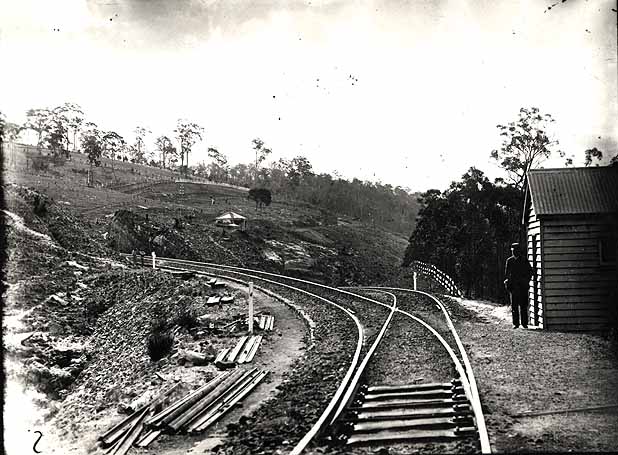
Lapstone is 3km south west of Emu Plains. The area was first referred to as Lapstone Hill in the 1820s. The name Lapstone may be a reference to the many smooth stones found in the area that resemble a cobbler’s lapstone. Land was reserved at Lapstone Hill for the resting of cattle travelling to and from Bathurst. Although the Lapstone Zig Zag (or “little” zig zag) was opened in 1867 a railway station was not built until 1964 and then a public school opened in 1971.
Top ↑
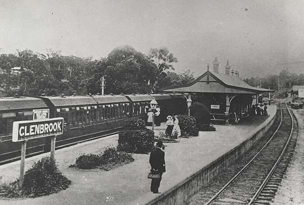
Glenbrook
Glenbrook is 67km west of Sydney between Lapstone and Blaxland. The site was originally known as Watertank after a stop on the original “little” zig zag” railway where the trains would stop to take on water from the Glenbrook Lagoon.
Sir John Jamison, whilst exploring the area around the Nepean and Warragamba Rivers named a tributary Glen Brook (now Glenbrook Creek). About 1870 the name was changed to Wascoe’s Siding (this refers to a railway stopping point of Wascoe, which is located in Blaxland) and then in 1879 to Glenbrook when the railway station opened.
Glenbrook Public School opened in 1892.
Top ↑
Blaxland
Blaxland is a town 6.5km west of Emu Plains, at the junction of the first three roads leading up the eastern escarpment, Cox’s Road, Mitchells Road and Old Bathurst Road. The village was originally known as Wascoe, after John Outrim Wascoe, the publican of the Pilgrim Inn (the first roadside inn to be built in the Blue Mountains in about 1826 by Barnett Levey) which he operated in the 1850s-60s.
The railway arrived in 1867 and in 1914 the name was changed to honour Gregory Blaxland.
A provisional school opened in Blaxland’s Flat in 1885 and in Blaxland’s Ridge in 1892.
![Land for sale at Blaxland, 1960. NRS 9149 [10/217] Poster in volume](/wp-content/gallery/toot-toot-the-great-western-railway-arrives/nrs914910-217_blaxland-poster.jpg)
Top ↑
Lennox Bridge
Lennox Bridge, in Mitchells Pass, is the oldest surviving stone arch bridge on the Australian mainland. The bridge was designed and built by David Lennox in the early 1830s to span a gully in the ascent from Emu Plains on the eastern side of the foothills.
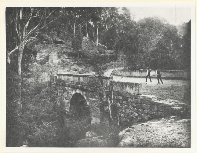
The road and bridge continued to be the main ascent route from 1836 to 1926 when the new highway was constructed. Nowadays the road is one-way down to Emu Plains and is a favourite route for cyclists.
Top ↑
Warrimoo
Warrimoo is a town on the Blue Mountains Range, 7km west north west of Emu Plains. The name may have been taken from the Aboriginal word meaning eagle. Although an earlier railway station did operate, Warrimoo Station opened in 1918 to coincide with the subdivision of the area.
Warrimoo Provisional School opened in 1942 and became Warrimoo South Public School in 1962.
Top ↑
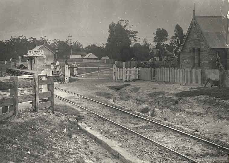
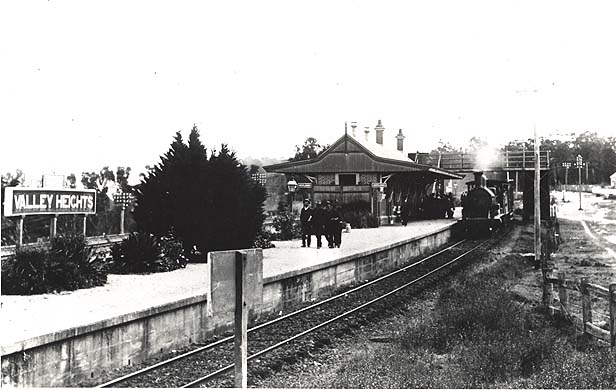
Valley Heights
Valley Heights is a small town located between Warrimoo and Springwood. As early as 1832 Alexander Fraser ran the ‘Valley Inn’. In 1875 the railway station opened as Eagers Platform, named after local landowner, Geoffrey Eager. Eagers Platform became The Valley in 1877 and then Valley Heights in 1880.
Top ↑
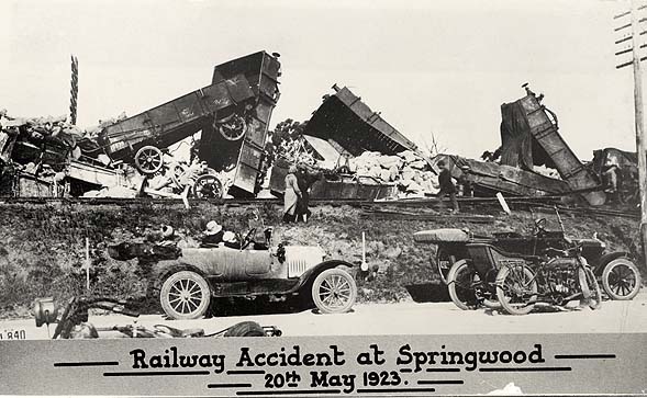
Springwood
Springwood is 78km west of Sydney and was named Spring-Wood by Governor Macquarie on his trip to Bathurst in 1815. In the following year a military outpost was established near this site which operated until 1845. It was a popular stopover for travellers, especially during the gold rush in the 1850s.
In 1867 the railway arrived and a station was built in the following year. The station was replaced by a Victorian Gothic style building in 1884. Many wealthy families from Sydney built country retreats in Springwood.
Springwood Public School opened in 1878.
Top ↑
Faulconbridge
Faulconbridge is 2.5km west of Springwood. In 1876 Sir Henry Parkes bought 600 acres for his country retreat and named it Faulconbridge after his mother. A railway station was built for Parkes’ convenience in the following year and the town took its name from Parkes’ house.
![Sketch of Sir Henry Parkes' mountain residence, Faulconbridge. From The Railway Guide. NRS16407-1-1[1]_p37](/wp-content/uploads/2013/04/NRS16407-1-11_p37.jpg)
![Description of Faulconbridge (and surrounding towns). From The Railway Guide. NRS16407-1-1[1]_p38](/wp-content/uploads/2013/04/NRS16407-1-11_p38.jpg)
Top ↑
References
NRS 16410 Blue Mountains Shire brochure
Brian Fox, Blue Mountains Geographical Dictionary, Brian Fox, 2006
Geographic Names Board of NSW: http://www.gnb.nsw.gov.au/name_search
Brian and Barbara Kennedy, Sydney and Suburbs: A history and description, Reed Publishing, 1982
John Low, Pictorial Memories Blue Mountains, Kingsclear Books, 1991
Research by
Suzanne Upton, Archivist Public Access