…resumed for the purpose of carrying out a system of public wharves and approaches thereto at Darling Harbour, and the waters at Port Jackson adjacent thereto…see the Act (PDF, 464kb)
About the Maps
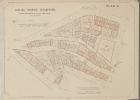
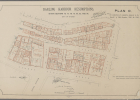
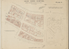
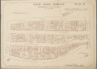
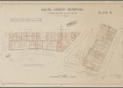
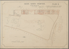
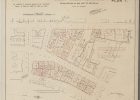
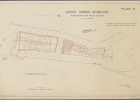
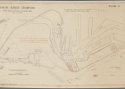
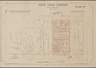
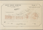
NRS 19348 is a complete set of maps of the Darling Harbour and Port Jackson resumptions that were created in response to the Darling Harbour Wharves Resumption Act 1900 (Act No.10, 1900).
Darling Harbour
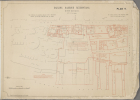
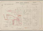
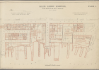
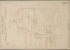
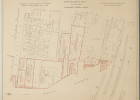
The sequence of maps arranged by the alphabetical letters display a detailed street view of Darling Harbour. The geographical area is bounded by streets and the Harbour and within this area the property blocks are outlined in red. The red outlines indicate the names of the owners and details of the lessees, lessors, mortgagees, mortgagors, etc. Also included is the street number and the size of the block.
The Rocks
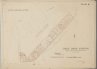
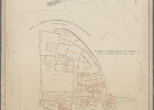
The last map in the sequence is a map of The Rocks resumptions; this area was included in the Darling Harbour Wharves Resumption Act 1900.
Key Plans
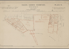
Key plans “A” and “B” provide an overall key to the area indicating the mapped areas around Darling Harbour by alphabetical letters. These letters correspond to the other maps in the set. The key plans also contain a reference table.
More information
- Series information in Archives Investigator
- Related series – NRS 12462 a partial set; maps are annotated differently but are otherwise the same.
List of maps used in this Gallery
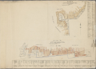
Key Plan A and B: Key Plan A – Showing boundaries of Plans G, F, E, D, C. Key Plan B – Showing boundaries of Plans L, K, J, I, H included on both plans is a reference table, 03 May 1900 [View in Archives Investigator]
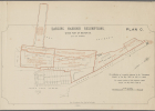
Plan C: Map of Resumption Area bounded by Port Jackson, George Street North and lower Fort Street (within part of section 90), 03 May 1900 [View in Archives Investigator]
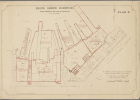
Plan D: Map of Resumption Area bounded by Lower Fort Street, Windmill Street, Kent Street North and Port Jackson (Within section 91 and Part of Section 90), 03 May 1900 [View in Archives Investigator]
Plan E: Map of Resumption Area bounded by Darling Harbour, Port Jackson, Kent Street North, Windmill Street, and Bettington Street (Within section 92), 03 May 1900 [View in Archives Investigator]
Plan F: Map of Resumption Area bounded by Darling Harbour, Bettington Street, Millers Road, Clyde Street (Within part section 92), 03 May 1900 [View in Archives Investigator]
Plan G: Map of Resumption Area bounded by Darling Harbour, Clyde Street, Millers Road, Kent Street, (Within section 93), 03 May 1900 [View in Archives Investigator]
Plan H: Map of Resumption Area bounded by Darling Harbour, Margaret Street, Kent Street and the Gas Company. (Within section 67) 03 May 1900 [View in Archives Investigator]
Plan I: Map of Resumption Area bounded by Darling Harbour, Sussex Street, Margaret Street, Erskine Street, 03 May 1900 [View in Archives Investigator]
Plan J: Map of Resumption Area bounded by Darling Harbour, Market Street, Sussex Street and Erskine Street (with Section 55 and part of Section 30), 03 May 1900 [View in Archives Investigator]
Plan K: Map of Resumption Area bounded by Darling Harbour, Sussex Street, Bathurst Street, Market Street, and Wharf Street (Within section 21 and part of 30), 03 May 1900 [View in Archives Investigator]
Plan L: Map of Resumption Area bounded by Darling Harbour, Bathurst Street, Duncan Street and Liverpool Street (within section 10 and 1), 03 May 1900 [View in Archives Investigator]
Plan M: Map of Resumption Area bounded by Port Jackson, Pottinger Street, Windmill Street and lower Fort Street (within parts of sections 90 and 91), 03 May 1900 [View in Archives Investigator]
Plan N: Map of Resumption Area bounded by Darling Harbour, George Street North, Argyle Street, Lower Fort Street and Princess Street (Within sections 85, 87, 88 and part of 86), 03 May 1900 [View in Archives Investigator]
Plan O: Map of Resumption Area bounded by George Street, Argyle Street, Gloucester Street, and Little Essex Street (Within sections 76, 77, 78, 79, 80, 82 and 84), 29 Aug 1901 [View in Archives Investigator]
Plan P: Map of Resumption Area bounded by Darling Harbour, George Street, Grosvenor Street, Cumberland Street and Gloucestor Street (Within Section 62, 63, 64, 68, 69 and 81), 03 May 1900 [View in Archives Investigator]
Plan Q: Map of Resumption Area bounded by Darling Harbour, Upper Fort Street, Argyle Street, Essex Street and Glouster Street (within Section 70, 71, 72, 73, 74 and 75), 11 Jan 1902 [View in Archives Investigator]
Plan R: Map of Resumption Area bounded by Argyle Place, Lower Fort Street, Windmill Street, and Kent Street North. (With section 89, 94 and 98), 03 May 1900 [View in Archives Investigator]
Plan S: Map of Resumption Area bounded by Darling Harbour, Upper Fort Street, Kent Street and Watson Road (within Section 95), 26 Nov 1901 [View in Archives Investigator]
Plan T: Map of Resumption Area bounded by Darling Harbour, Kent Street, Crescent Street, Cumberland Street, Essex Street, Grosvenor Street (Within section 65 and part of section 66), 14 Apr 1902 [View in Archives Investigator]
Plan U: Map of Resumption Area bounded by Darling Harbour, George Street, Bethel Street, Circular Quay, Queens Wharf (Within section 83 and part of section 86), 12 Jun 1902 [View in Archives Investigator]
Plan V: Map of Resumption Area bounded by Darling Harbour, George Street North, Sydney Cove, Port Jackson (Within Section 86), 22 Jan 1902 [View in Archives Investigator]
Plan W: Map of Resumption Area bounded by Darling Harbour, Kent Street, Margaret Street, Sussex Street and Erskine Street (Within Section 57), 22 May 1901 [View in Archives Investigator]
Plan X: Map of Resumption Area bounded by Darling Harbour, Bettington Street and Victoria Terrace. (Within section 92 Plan X), 03 May 1900 [View in Archives Investigator]
Plan Y: Map of Resumption Area bounded by Darling Harbour, Kent Street, Windmill Street, Hart Street, Millers Road (Within part of sections 92 and 93), 09 Dec 1901 [View in Archives Investigator]
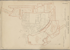
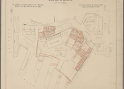
[25]: Plan showing the Rocks resumption, bounded by Kent Street, Dawes Point, Sydney Cove, Gosvenor Street and Circular Quay, scale: two Chains to an Inch, 23 Jul 1901 [View in Archives Investigator]
Order High Res Digital Copies
The images in this gallery are low resolution. You can use the online shopping cart option in Archives Investigator to purchase high res [600dpi] digital copies of the maps. Select a map in the list above using the “View in Archives Investigator” option or browse the full list of maps here.
![[25] - Plan showing the Rocks resumption, bounded by Kent Street, Dawes Point, Sydney Cove, Gosvenor Street and Circular Quay, scale: two Chains to an Inch [25] - Plan showing the Rocks resumption, bounded by Kent Street, Dawes Point, Sydney Cove, Gosvenor Street and Circular Quay, scale: two Chains to an Inch](/wp-content/gallery/darling-harbour-sydney/cache/19348_025-60.jpg-nggid03471-ngg0dyn-140x100x100-00f0w010c011r110f110r010t010.jpg)